What lies beneath the fields north of Priory Park
Drive along Huntingdon Road towards Little Paxton, and the fields either side look like ordinary Cambridgeshire farmland. A new survey suggests they are anything but. Hidden a short way below the plough soil is what appears to be an ancient settlement covering around five hectares, along with a line of mysterious square enclosures, a ring ditch and the ghostly outlines of medieval strip fields.
The findings come from a geophysical survey of land north of Priory Park, carried out by SUMO GeoSurveys between December 2025 and March 2026. The work was commissioned by Stantec on behalf of Bloor Homes as part of early archaeological investigations ahead of a proposed residential development. The report, dated April 2026, is publicly available on Huntingdonshire District Council’s planning portal.
Where the survey took place
The site covers roughly 50 hectares on the northern edge of town. Huntingdon Road (the B1043) runs straight through the middle of it, Gallow Brook and the River Great Ouse mark its northern and north-western edges; the Mill Lane allotments sit to the west, Mill Lane and Priory Road form the southern boundary; and the East Coast Main Line runs along the east.
Not every field could be surveyed. Around 21 hectares, mostly to the north-east beyond Gallow Brook, were left out because access wasn’t available, so the picture is still incomplete.
Seeing without digging
Geophysics is the archaeologist’s equivalent of an X-ray. Rather than digging, the team pushed (and in places towed with a quad bike) a cart fitted with four sensitive magnetic sensors up and down the fields in lines just one metre apart, taking a reading every few centimetres. Each reading was pinned to a precise location using satellite positioning.
The principle is simple, even if the equipment isn’t. When people dig a ditch or a pit and it later fills up with topsoil, rubbish and organic material, that fill is slightly more magnetic than the natural clay around it. Anything that has been heated, such as a hearth, oven or kiln, becomes more magnetic still. The sensors can pick up differences of less than a thousandth of a percent of the Earth’s magnetic field, and when thousands of readings are plotted as a greyscale image, long-lost ditches, pits and enclosures appear like a faint drawing on the landscape.
A settlement in the west
The most striking results came from the field on the west side of Huntingdon Road, between the sewage works and the Mill Lane allotments. Here the survey revealed a dense tangle of features spread across some five hectares: boundary ditches, enclosures, what look like paddocks for livestock, trackways, circular ring ditches and a scatter of pits.
Just as intriguing are the strongly magnetic spots that suggest areas of burning and possible kilns or ovens, the kind of evidence you would expect from people cooking, working and perhaps making things on site. The features are laid out along two clear alignments, and some of the main boundary ditches carry on across Huntingdon Road into the field opposite.
This isn’t a complete surprise. Cropmarks, patterns that show up in growing crops when seen from the air, had already been recorded here in the Cambridgeshire Historic Environment Record, and were thought to represent a prehistoric or Roman settlement. The survey confirms that something substantial is there and maps it in far more detail than ever before. What it can’t do is tell us exactly how old it is.
Square enclosures and a ring ditch
In the south-east of the site, close to the railway, the survey picked up a line of square and near-square ditched enclosures. The largest is around 36 to 38 metres across and contains a circular ring ditch about 14 metres in diameter, with an entrance facing south-east. A ditch runs from it to a pair of smaller joined enclosures, each around 20 metres across, one with its own entrance and one apparently sealed. Another square enclosure, roughly 40 by 32 metres, sits nearby, and small pit-like features appear inside all of them.
Ring ditches are often the remains of burial mounds or roundhouses, and square enclosures can have a range of uses, so interpreting these will need more evidence. Again, they match cropmarks previously spotted from the air. A further double-ditched ring, around 25 metres across, is recorded just to the north of the surveyed area.
A fainter cluster of possible enclosures and pits was also found in the smaller field north of the sewage works, though these responses are weak and harder to read.
Traces of the medieval town fields
Running across almost every field are long, roughly parallel lines left by ridge and furrow, the pattern created by medieval and later ploughing. From the medieval period this land formed part of the agricultural landscape serving St Neots, and the central southern part of the site belonged to one of the town’s great common fields, known as Priory Field.
The survey also traced former field boundaries shown on Victorian maps and two ponds that appear on the 1886 Ordnance Survey map but have since been filled in. That same map shows the southern part of the site as parkland, a reminder of how much this edge of town has changed.
A landscape with a long history
The new results fit into a wider story. Records for the area include a Bronze Age burial mound in the western part of the site, now ploughed flat, and further ring ditches in the surrounding landscape. Roman cremation urns have been found in the gravels on the eastern bank of the river, and across the water there are records of Roman pottery, animal bones and what may be the remains of a boat quay. Early medieval postholes, ditches and beam slots have also been recorded in the south-west of the site, though without finds to date them.
Put together, it paints a picture of a riverside landscape that people have been living in, farming and burying their dead in for thousands of years.
What happens next
Geophysics is a first step, not the final word. It shows where features are likely to be, but it can’t date them or reveal everything, and some buried remains produce no magnetic signal at all. The report itself is careful to point this out.
Surveys like this usually help decide where further archaeological work, such as trial trenching, should take place as part of the planning process. The report will be deposited with the national OASIS archaeological database and the Cambridgeshire Historic Environment Record within 12 months, adding to the county’s knowledge of its past.
For now, the fields north of Priory Park have given up a tantalising glimpse of an older St Neots, one that was busy and lived-in long before the priory, the market or the railway arrived.
Read the full report
This article is based on Geophysical Survey Report 21283: Land North of Priory Park, St Neots, Cambridgeshire by SUMO GeoSurveys (April 2026), which can be viewed on Huntingdonshire District Council’s public planning portal under planning application reference 25/01694/OUT
Visit St Neots Museum
St Neots Museum is located in a former lice station on New Street, presents the history of our busy market town of St Neots on the River Ouse, from prehistoric times onwards and includes the original early 20th-century gaol cells where prisoners were detained. The permanent exhibitions are full of exciting and interesting stories from the area and well worth a visit if you’ve enjoyed this article.
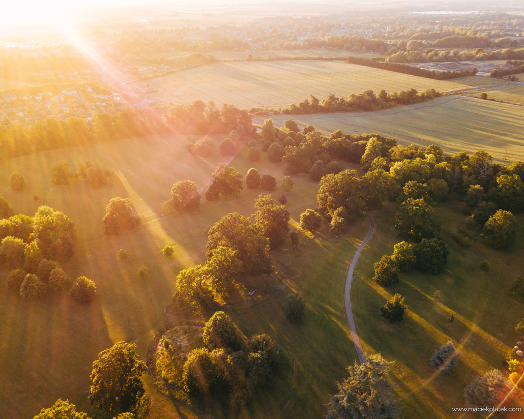
Photo by Maciek Platek from Priory Park looking towards the two main fields surveyed.

